|
|
 |
|
Project Aim
To develop software to automatically detect geological faulting in seismic data sets.
Background
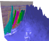
| Three-dimensional seismic data sets provide a vital contribution to geological understanding. One key geological aspect that can be gleaned from such 3D seismic data sets, is the pattern of geological faulting. A typical fault can be seen in the figure on the right (2D slice). |
|
|
Traditionally such faults have been identified manually. This can be extremely time consuming. This 3 year project aims to use image processing techniques to automatically detect fault surfaces, without any human input. |
A summary of the work done to date can be found here.
|
|